Buried Heritage

A community project exploring the rich archaeology of the Forest of Dean

Menu

Skip to content
  • Home
  • About the Foresters’ Forest
  • LiDAR surveys
    • Background
    • Survey results
    • See the LiDAR
  • Excavations
    • Yorkley and Tomlin
      • Yorkley
      • Tomlin
    • Soudley camp
    • Ruardean Castle
    • Ruardean Hill
    • Mile End
    • Worcester Walk
  • Other resources
    • Timeline
    • School resources
    • Image gallery
    • Forum
    • Links
    • Posts page …

Background

The work carried out in the forest was based on barely visible changes in the forest floor that were revealed using detailed LiDAR surveys. The first was carried out by Gloucestershire County Council and Forestry Commission in 2012.

731010 67KT5VVJ items 1 harvard1 default asc https://www.deanarchaeology.org.uk/buriedheritage/wp-content/plugins/zotpress/
Gloucestershire County Council and Forestry Commission (2012) ‘Forest of Dean Archaeological Survey: LiDAR Survey’. Archaeology Data Service. Available at: http://dx.doi.org/10.5284/1012711 (Accessed: 27 February 2016).

What is LiDAR?

LiDAR stands for Light Detection And Ranging and is a technique that is a remote sensing method using light in the form of a pulsed laser to measure ranges (variable distances) to the Earth.
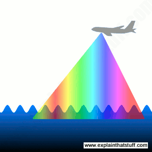
LiDAR

The use of LiDAR in forestry surveying is explained nicely in a Journal of Forestry article entitled “Lidar Remote Sensing for Forestry”

How does LiDAR work?

Laser pulses are emitted from a device attached to a vehicle such as a plane. The laser pulses create a topographic map similar to how a bat uses echolocation. The light shot down from the plane bounces off objects below (leaves, branches, trees, rocks, etc.), returning to hit a detector on the bottom of the plane. The device then calculates where the object is using satelites to help work out the height of the emitter from the ground, the height of the receiver from the ground, and the time it took to receive the reflected pulse – which gives the distance from the emitter – and the precise location of the object.

As the pulse hits a leaf, flower or branch, the time taken will be less than if it hit the ground and so as the survey progresses in a grid across an area and back again, it is able to establish what is most likely to be solid (like the ground or a structure) and ignores the rest.
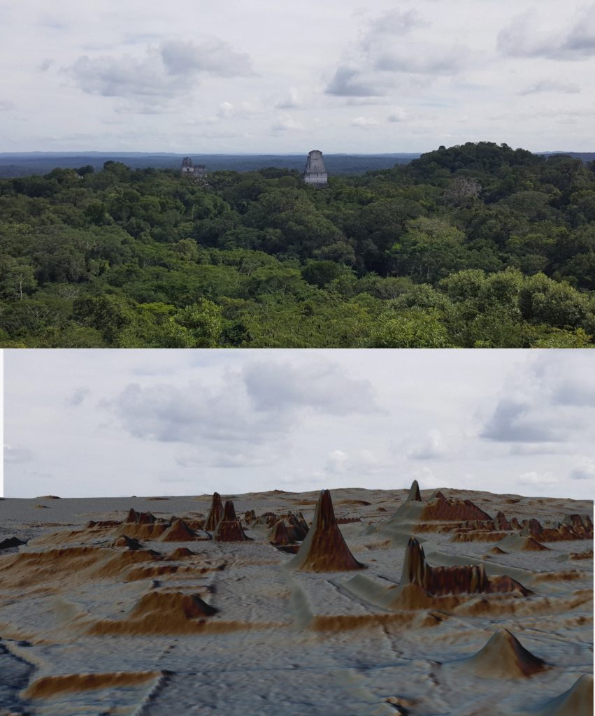
LiDAR used to reveal lost Miyan cities

{731010:EKQ8VPE2};{731010:G5M8UULE};{731010:GMKY9B9E} harvard1 default asc no 487
Chen, S. (2020) ‘Laser-Carrying Airplanes Uncover Massive, Sprawling Maya Cities’, Wired. Available at: https://www.wired.com/story/laser-carrying-airplanes-uncover-massive-sprawling-maya-cities/ (Accessed: 10 December 2021).
Dubayah, R.O. and Drake, J.B. (2000) ‘Lidar Remote Sensing for Forestry’, Journal of Forestry, 98(6), pp. 44–46. Available at: https://doi.org/10.1093/jof/98.6.44.
Woodford, C. (2021) LIDAR: a simple introduction, Explain that Stuff. Available at: http://www.explainthatstuff.com/lidar.html (Accessed: 30 November 2021).

Widgets

Recent Posts

  • Hello world!
  • Seems the tech works so far …
  • The story so far …

Recent Comments

No comments to show.

Archives

  • February 2022
  • October 2016

Categories

  • outreach
  • overview
  • Uncategorised
Proudly powered by WordPress | Theme: Illustratr by WordPress.com.